Category Archives: maps

Census 2021: Who gets a letter and who gets a paper form?

This is an extended article, which was originally posted on The Conversation on 18/03/2021.

In England, Wales and Northern Ireland, we should all now have received either a letter with a 16 digit code or a paper form to fill in for the 2021 Census. There are lots of great reasons why we should respond to the census, aside from it being a legal requirement. Among other things, it’s a good way to help provide an accurate snapshot of your community, which means people will get the services they needs at a local level. The Conversation and the Royal Geographical Society (with IBG) have both posted more information about what the census is and why it is important.

The census is a fascinating data set that’s vital to many areas of research and government decision making. It provides us with a count of the population, but also a wide range of demographic data like age, gender, family relationships, socio-economic information, ethno-cultural background, health, and some voluntary questions, including religious identity and sexuality.

This is the first census that most people will be asked to complete online. However, some have received paper forms through the post, while others have just received a letter asking them to fill in the census online. Though the mechanics of the census may appear complex, the reasons why are actually quite straightforward.

So who gets a letter, who gets a form and why? The Office for National Statistics (ONS) (which is coordinating the census) has tried to determine who gets what by assessing which households are likely to find it impossible or more difficult to respond to the census online. These households (around 10% of all households) have been sent a paper form. Everyone else has received a letter with a code, asking them to complete the form online (however, it’s important to note that if you received a form, you can still respond online and if you got a letter, you can request a paper form if you want).

Online or by post?

There are a number of good reasons for filling out your form online – it saves the ONS time and money when collating the results and means we can get more accurate data.

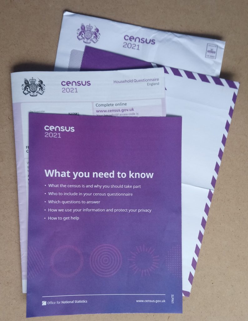
The 2021 Census form

You might be thinking: “what about my Aunt Muriel who received a letter? She doesn’t use the internet, why hasn’t she got a form?” This is because the ONS doesn’t know who’s able and willing to submit the form online – they can only model this based on the data they have.

As statistician George Box said: “All models are wrong, but some are useful”. This means that while the ONS has modelled who will (and who will not) respond online, even if they get 95% of people in the right group, there will be some errors.

There’s a term for this in the field of Geographical Information Systems (often shortened to GIS, the systems and tools we use to manage and analyse location data) – an ecological fallacy. This means that there will be cases which contradict the ONS’s model. For those who the ONS has deemed unable or unwilling to complete the census form online, there will be some who don’t fit this criteria and vice versa. This is why the ONS has included a code on the forms. If you know someone who needs a form, but is having problems requesting one, you can request one on their behalf.

The hard to count index

How did the ONS model this information? The ONS created a “hard to count” index to measure who might not respond to the census (also used for the 2001 and 2011 censuses). However, the 2021 census is different as this is the first time it’s tried to do a census “online first”, which means the ONS also had to include the digitally excluded into its index.

The key data used to drive this was internet access data from Ofcom, mobile internet connectivity (also from Ofcom) and information on who has already interacted with government websites (such as via the DVLA and HMRC). This data was used to create an area-based model, with each area assessed as either being able to complete the census online, or needing paper forms. Each area contains about 1,500 people and are known by the ONS as LSOAs (lower layer super output areas). This was tested and refined together with many other aspects of the census in the ONS’s big rehearsal for the census in 2019. There are lots more details in their report EAP102 Hard to Count index for the 2021 Census

Internet User Classification

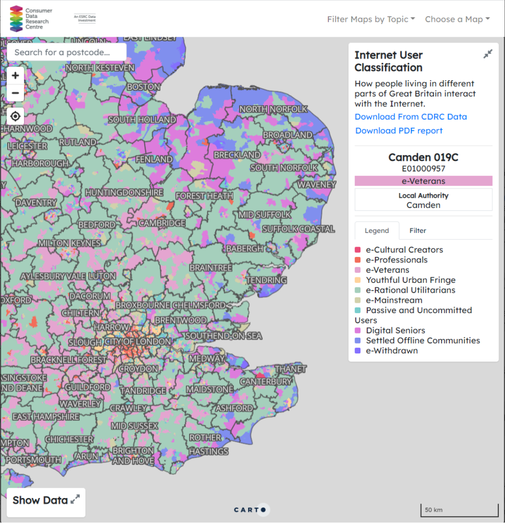
While ONS have not published their Hard to Count index, they have shared it with Local Authorities to help them target their census engagement work. A similar example looking at who is digitally excluded is the Internet User Classification, created by the Consumer Data Research Centre, open and freely available for anyone to use. Here, they looked at a range of factors (including internet connectivity and usage) and created a geodemographic classification identifying who uses the internet (e.g. e-Cultural Creators, e-Professionals) and who does not (e.g. Settled Offline Communities and e-Withdrawn). Geodemographics have some advantages over indices, in that they can help describe who doesn’t have internet access, and can be used to identify specific measures to help address this and/or used to identify individuals or groups with specific characteristics. 

CDRC Mapmaker, showing Internet User Classification data. 

However, we need to remember our ecological fallacy from earlier – not everyone in “e-Cultural Creators” (the group with the highest level of internet access/use) will have access to the internet and not everyone in “e-Withdrawn” (the group with the lowest level of internet access/use) will not have access to the internet. It is a model – a useful model, but a model nonetheless. If you are interested in Geodemographics, CDRC have a training course on Geodemographics, what they are and how you can create them (free to access, but you need to sign up for an account). 

One other thing to consider is what if the model is wrong? No model is 100% correct, so there will always be people who are incorrectly allocated to one group or another. When using the model, this needs to be remembered, and the suitable infrastructure needs to be in place to support this (i.e. being able to request a paper form if you want one). How much resource this should be given is a tricky question – and one that varies depending on the impact of getting someone in the wrong group. 

Hopefully this helps explain the why question. There are many more details on the ONS website, particularly in their papers documenting the methods used to run the Census at https://uksa.statisticsauthority.gov.uk/about-the-authority/committees/methodological-assurance-review-panel-census/papers/, particularly the “hard to count” (EAP102) and “maximising response” (EAP113) papers. Thanks very much to David Martin (University of Southampton) for pointing me to the resources in question, Tom Chadwin for his suggestions improving this article, and Kuba Shand-Baptise at The Conversation for her comments and input. If you are interested in GIS and the Ecological Fallacy, I can recommend GIS: Research Methods (first chapter free online).

This is an extended article, which was originally posted on The Conversation on 18/03/2021.

Online teaching: More reflections

This blog post is the next in the series on running training sessions during the pandemic. As a recent Rasters Revealed conference there was a great session on running training courses during the pandemic and I thought I would share my experiences. This builds on my previous posts about teaching online and CPD.

Since March I have run 10 different training courses, a mixture of 3 or 4 half day sessions. There is always potential to improve more, but I think overall my structure works reasonably well. I have certainly received great feedback from my course participants.

“I loved the interactive bits, the worksheets and the breakout rooms. They” were really hands on and felt like a normal course, even though the course took place online.”

Astrid Pape, PhD Candidate, Freie Universität Berlin
Introduction to GIS, Geospatial Data & Spatial Statistics course, November 2020

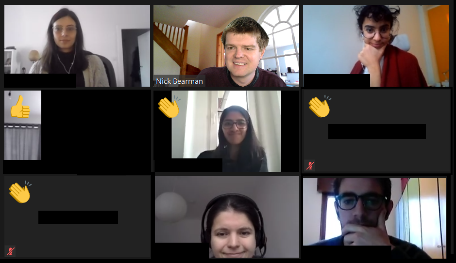
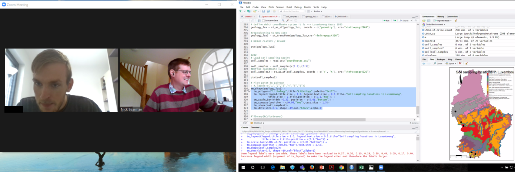
Screenshot of my teaching session in Jan 2021

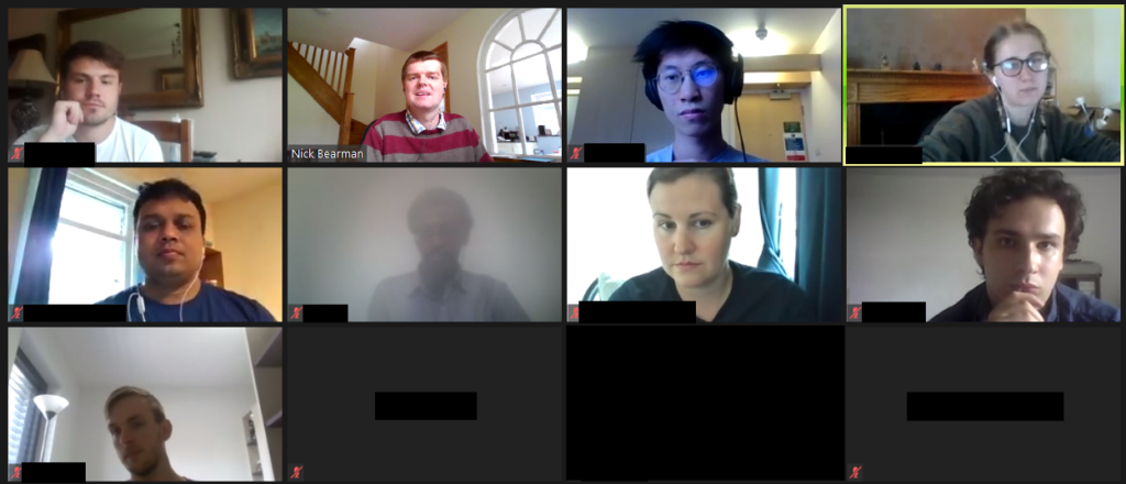
I run the courses on Zoom, and limit the sessions to 3-4 hours maximum during a day – otherwise it ends up being a lot of intense screen time, which doesn’t help the learner, or me! Each session has a mixture of presentations (20-40 min) and then practical sessions. For the practical sessions, I split the main group up into small groups of 4-5 people using the breakout rooms feature. The practical sessions last for up to an hour, and I ‘walk around’ the groups by visiting each breakout room in turn and see how people are getting on. If they have questions, they can share their screens, and most of the time they group members talk to each other and share their questions within the group. They also have the option of pressing the ‘Ask for Help’ button which sends me a message, saying so-and-so has a question in room 2, and I can go to the room and see what their question is.

Over the whole period of the course (1-2 weeks) I run a Slack channel for that particular group. This allows me to share links to materials, slides, Zoom, videos, etc. as well as giving the students the option to ask questions to the group, or just to me (via the DM feature). During the actual sessions I also have 10 min at the end where I ask everyone to post a question in the Slack discussion about the material we have just covered. This is a great way of getting questions out of people and I then talk through the answers, adding in links later on if I don’t have them to hand there and then. All the sessions are also recorded and available to the participants (only) for 3 months.

Questions in Slack from a training session

I hope this is useful – if you have any experiences you’d like to share, please do in the comments below!

If you are interested in GIS training, then I have some courses coming up in Feb and April, and I am always happy to talk about running a course for your research group or organisation – just get in touch.

Cross-posted from https://www.geospatialtrainingsolutions.co.uk/online-teaching-more-reflections/

PDR and the Pandemic

Our Professional Development Record (PDR) hours—CPD in the UK—are a key part of the surveying and geospatial professions. Previously PDR would have involved a mixture of in-person training, in-person conferences and self-study training materials. With the Covid-19 restrictions on meeting other people face-to-face, meetings are no longer possible, at least in the short term. Online video conferencing can substitute for some in-person events, and many PDR requirements are being relaxed to allow completely online PDR hours. So far, video conferencing has worked very well for training sessions and conferences, but I don’t think it will completely replace face-to-face meetings for a long time yet.

PDR requirements vary between industry and country, but all have some required training element, which would often be completed by attending in-person courses. This now all needs to be done online, at least in the short- to medium-term, and some accreditation providers have had to update their policies to allow this to be completed only online.

Providing one-to-one support during a training session. Video (left) and student sharing their screen (right)

In the UK, the Royal Institute of Chartered Surveyors (RICS) and the Chartered Institution of Water and Environmental Management (CIWEM) have one of the more formalized and strict PDR requirements. Both groups have moved all of their PDR courses online.

In the U.S., the GIS Certification Institute is completing its Technical Knowledge Exam online, and URISA (Urban and Regional Information Systems Association, one of the leading GIS professional bodies) has moved one of its in-person leadership academies online. In general, these events

have gone very well, but the online medium poses unique challenges of encouraging social interaction in an online space.

Certification for your PDR is also a tricky element depending on what area you are working in. Some of the certification elements can easily be completed online, using multiple choice answers or written responses to questions. Some of the more practical elements, like showing that you know how to service an RTK GPS unit, are tricky to examine online. I see a future where some of this might be done over live video calls, allowing the person being evaluated to demonstrate their skills to an assessor.

I run a number of small (10 to 20 attendees) in-person training courses in GIS and spatial analysis. All of these have had to move online, posing a range of different challenges. We all have access to video conference tools, and I think it is reasonable to say that some are better than others.

For most of my training courses I have used Zoom, which has worked very well with groups of up to 20 or so. My courses are a mixture of presentations (to the whole group) and then self-led practical workbooks, with the students receiving one-on-one support from me and a teaching assistant. I used the ‘Breakout Rooms’ facility within Zoom to allocate every student to their own room, and I could visit them and see how they were getting on, and they could share their screen if they were having any problems with their work.

Running a training course on Zoom.

This worked well, but we did miss out on the social aspect of the session – discussions over lunch, and students helping each other during the course. This is something that concerns many trainers and attendees alike, and I hope to see better solutions come along over the next few months.

I made use of the various security features in Zoom (particularly the Waiting Room) so we had no issues of Zoom bombing, where unauthorized viewers gate-crash the meeting and disrupt events. Moving courses online has allowed many more people to take part, particularly those who would otherwise be unable to travel for whatever reason. I have run several courses where participants have said it is great that the course is online, as otherwise they would be unable to take part, due to childcare requirements.

This increase in numbers has also been seen in bigger conferences and MOOCs, with a big uptick in numbers. For example, the very popular ESRI

Cartography MOOC (Massive Open Online Course) reached more people than last year (35,772 participants in the latest offering) and has also had a 31 percent higher completion rate. Some smaller GIS conferences that would usually run in person have also received an up tick in numbers from moving online, including FOSS4G UK 2020, which went from typically 100 attendees to 400, GISRUK 2020, which went from typically 150 to 300 and QGIS North America 2020, which went from typically 50 or so to 200.

Nearly all of these conferences are also now available as recorded videos online, providing a great resource for future learning. It is great to see these increases in numbers with more people learning what GIS can do and being able to apply it in their own areas of work.

While the move to online has many advantages, I don’t believe it will entirely replace in-person training and conferences. The social interaction element of online conferences has so far seemed the hardest to replicate online.

There are some very interesting platforms to encourage networking, but I’ve not yet seen any that work really well. I can see everything staying online until the end of 2020, but beyond that I see a hybrid model going forward, where there will be substantially more online events than before, but there will still be some in-person events.

Whether we can manage to run great hybrid events with links between the group physically in the room and the group online remains to be seen.

PDR Requirements in the U.S.

Licensure for land surveying varies from state to state, but there are more similarities than differences. Typically, licensing is handled by a state board of professional licensure, often the same board that oversees engineering licenses.

The requirements for licensure by state are similarly defined in the laws, codes, and statues for each. The requirements are typically a combination of experience, education, and examinations. Most require passing one or more standardized set of tests from the National Council of Examiners for Engineering and Surveying (NCEES), a non-for-profit organization dedicated to advancing professional licensure for engineers and surveyors.

Most states have adopted continuing education requirements and often the reporting of one’s hours is up to the licensee but is subject to an audit. Sometimes the requirements are stated as “units” and other times as hours, and the annual requirements are typically about 15 hours per year.

The resources for education credits or hours are typically met from educational institutions, surveying association/society conferences and seminars, and commercial education credit firms. There are a number of nationwide firms offering these, like PDH Academy and GeoLearn, some presented locally and others online.

Since the beginning of the pandemic, there has been a sharp increase in surveyors tapping online resources, and in turn, there has been a rise in online resources. Some states surveying associations, like West Virginia, have rapidly increased online course offerings.

For GIS professionals, the GISP certification, via the GIS Certification Institute (gisci.org), is broadly viewed as the standard. While it is not a license, like those required by states for surveying and engineering, the GISP can be a job application or contract requirement like other professional certifications. This is similar to the Certified Survey Technician, hydrography surveyor, and floodplain surveyor programs of the National Society of Professional Surveyors.

The GISP recertification requirements are a points system, based on a combination on education, contributions to the profession, and work experience. GIS is, by nature, very digital, and so is GIS education. Many resources for online education and collaboration were well established even before the pandemic began.

Originally written for xyHt and posted at https://www.xyht.com/education/pdr-and-the-pandemic/.

National Map Reading Week

The 27th May to 2nd June is National Map Reading Week, created by the Ordnance Survey to promote maps, mapping and all things to do with space! There has been a great selection of coverage across the internet – one of my favourite was a ‘map-folding’ competition featuring the Calder Valley Mountain Rescue Team, setting the bar at 8.16 seconds!

When we say ‘maps’ people are often talking about the paper based product, I would argue that reading a digital map is as an equally important skill. Navigation is always something that has been vital to humans, and now that we travel further than ever before, knowing where we are going is vital!

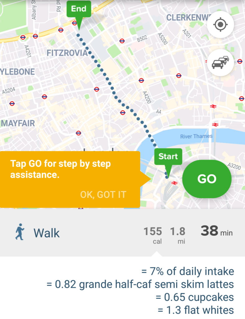
For on-phone sat nav, Google Maps may be the go-to choice for many and works very well. It certainly works well for me in the car when required! However, for public transport in London in my opinion, you can’t beat CityMapper. It gives you a huge range of flexibility of different methods (walk, bike, public transport) and also gives you costs which is very handy. They also have a good sense of humour, showing how many calories a walk or cycle will use up and how many cupcakes that is!

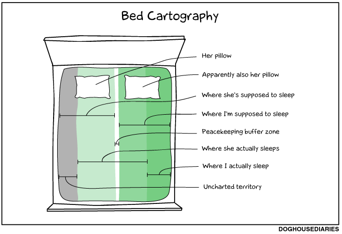
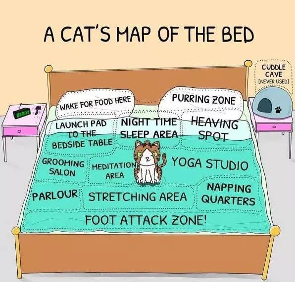
This is also a nice excuse to mention two other map related things: bed cartography for a) humans and b) cats!

http://thedoghousediaries.com/3586

https://www.facebook.com/weloveallthecats/photos/a.577358232351406/2200795980007615/?type=3&theater

Finally, just to say this is a great time to get out there (with or without a map) and enjoy the scenery!

View of Fortuneswell and Weymouth from Portland


UAVs, spatial data and data use: GISRUK 2019, Newcastle University

GISRUK is the annual GIS Research conference in the UK which showcases the latest in GIS (Geographical Information Science) and Geomatics Research from the UK and across Europe. I attended the 4-day conference at Newcastle University and it was amazing to see the latest developments from across the geospatial community.

One of the key themes for me that emerged from the conference was the debate between whether spatial data is ‘special’ or is it data just another data type, one among many? For many years when GIS was a niche area requiring specialist skills to use, there was a clear argument that spatial was special. Now the bar of entry to using spatial data is much lower, through the use of tools such as Google Earth, Tableau and even ArcGIS Pro, which means many more people can get the benefit of using spatial data and analysis. Spatial data is another tool in the toolbox of analysts, which allow us to be solution architects (solving problems) rather than geo-engineers (tinkering with projections and file formats). I don’t think we are yet at the point where using spatial data is as easy as using an Excel table, but we are so much closer than we were even just 5 or 10 years ago. The traditional desktop GIS package (ArcGIS / QGIS) is no longer the only way of working with spatial data: advanced users have more data science orientated solutions such as Python or R, and non-technical users can get great maps from Tableau. In fact James Bowles found many organisations in the third sector (charities and NGOs) use Tableau to do data analysis (including spatial analysis) rather than using tools like ArcGIS.

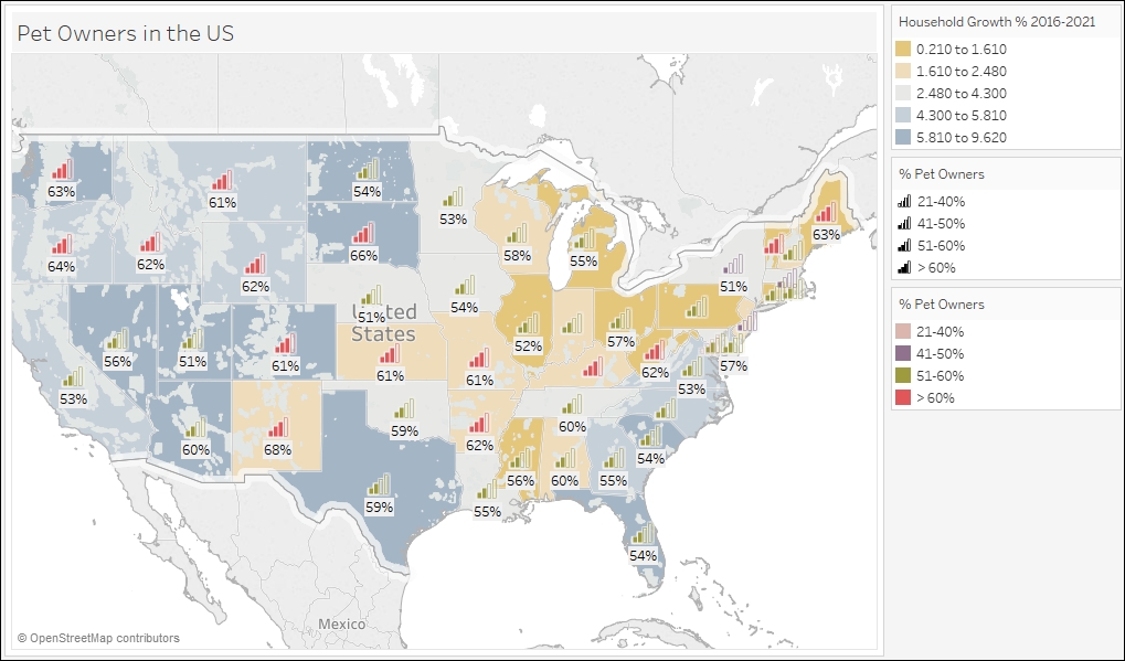
Spatial data is becoming more widely accessible, with many users in the third sector choosing Tableau for their spatial analysis, over traditional desktop GIS such as ArcGIS or QGIS.

One of the regular features of the GISRUK Conference Series is a key focus on Early Career Researchers, those students who are currently studying MScs or PhDs. About 60% of them will go straight to work in industry after their studies, so this is a great opportunity for them to find out more about working in industry. Both junior staff and senior consultants came in from ARUP to explain what ARUP do and why the students’ skills are vital in industry. One of the big areas of growth is the combination of remote sensing and machine learning; these skills are very sort after by industry and there are some very exciting developments in the earth observation field.  Machine learning and AI (artificial intelligence) are gaining a lot of coverage, both in terms of how and where we use them, but also from the point of view of ‘how do we use AI ethically?’, and ‘what new questions do we have to think about when we are using AI & ML?’. One of the keynote speakers, Prof. Renee Sieber talked about the importance of public participation in what she termed ‘GeoAI’ (AI applied in a geospatial setting) and the fact that the fact that AI is not unbiased at all; it reflects our societal biases and we need to be careful when using it.

The use of spatial data is fundamental to all of the work presented at GISRUK, and availability of data is often not as clear cut as it really should be. In the panel discussion on ‘How will the opening up of geospatial data help the GIS community?‘ one of the key elements that was discussed was data infrastructure. The provision of metadata is often quite important in terms of being able to select suitable data for specific projects, and if we are to further develop automated data process (including data selection) then comprehensive metadata is key to much of this, and currently fairly lacking. Dr Gobe Hobona, from the Open Geospatial Consortium, demonstrated how the OGC have been instrumental in developing a range of standards that are key to the interchange of spatial data between different software and organisations, including the provision of metadata. Gobe also mentioned the developments of UAVs, both as tools for spatial data collection but also as transformative decides in geospatial interoperability, allowing access to more and more varied data sources. They are also very cool, such as the spectacular swarms of UAVs we saw at the recent Beijing Olympics!

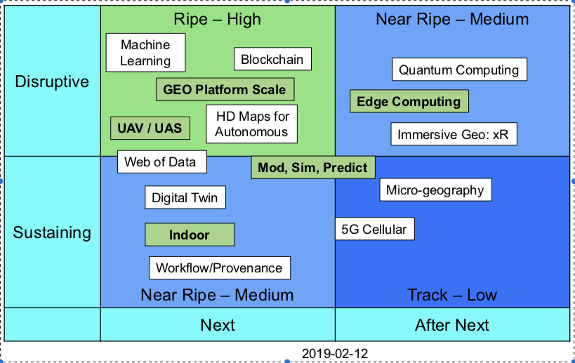
Upcoming Trends identified by the Open Geospatial Consortium, including UAVs and indoor geospatial solutions (see also https://github.com/opengeospatial/OGC-Technology-Trends).

UAVs were mentioned across many different themes in the conference, including for data capture, combination with AI (to identify cracks in road surfaces) to impact on birdlife in wildlife reserves. They are clearly now entering a phase where they are part of a wider toolbox, rather than a novelty in themselves, and so are maturing into a new data source and product. There was also a very interesting presentation by Kevin Minors on crowd management, including techniques for modelling the crowd as a whole from a series of static data points, which has a wide application in highly variable crowds, such as railway stations.

Overall this was a great conference with a fascinating insight into the cutting edge of research in spatial data and GIS. Next year GISRUK is at UCL and Birkbeck, University of London, April 21st to 24th – see you there!

To find out more about new GIS technologies, how to use them and how they could benefit your research and analysis, sign up to the Geospatial Training Solutions mailing list or send me an email!

Cross-posted from
https://www.geospatialtrainingsolutions.co.uk/uavs-spatial-data-and-data-use-gisruk-2019-newcastle-university.