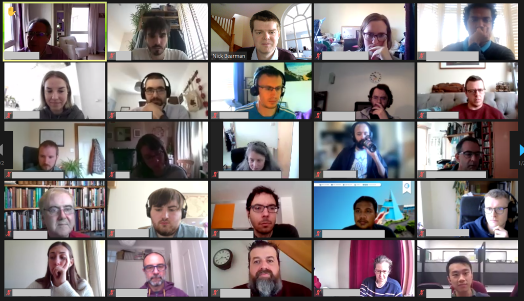
We had a great GISRUK conference this year. We were online again (as we were in 2020), because of Covid-19, with Scott Orford at Cardiff University hosting, we had a really smooth running online conference. There was a very strong field of submissions, with 24 short papers and 43 long papers being presented, with a significant proportion being presented by Early Career Researchers. The papers themselves and the recordings are all available on the GISRUK website. Attendance was also very good, with typically >100 people attending the keynotes and >50 people in each of the presentation sessions.
Attendance at GISRUL was very good
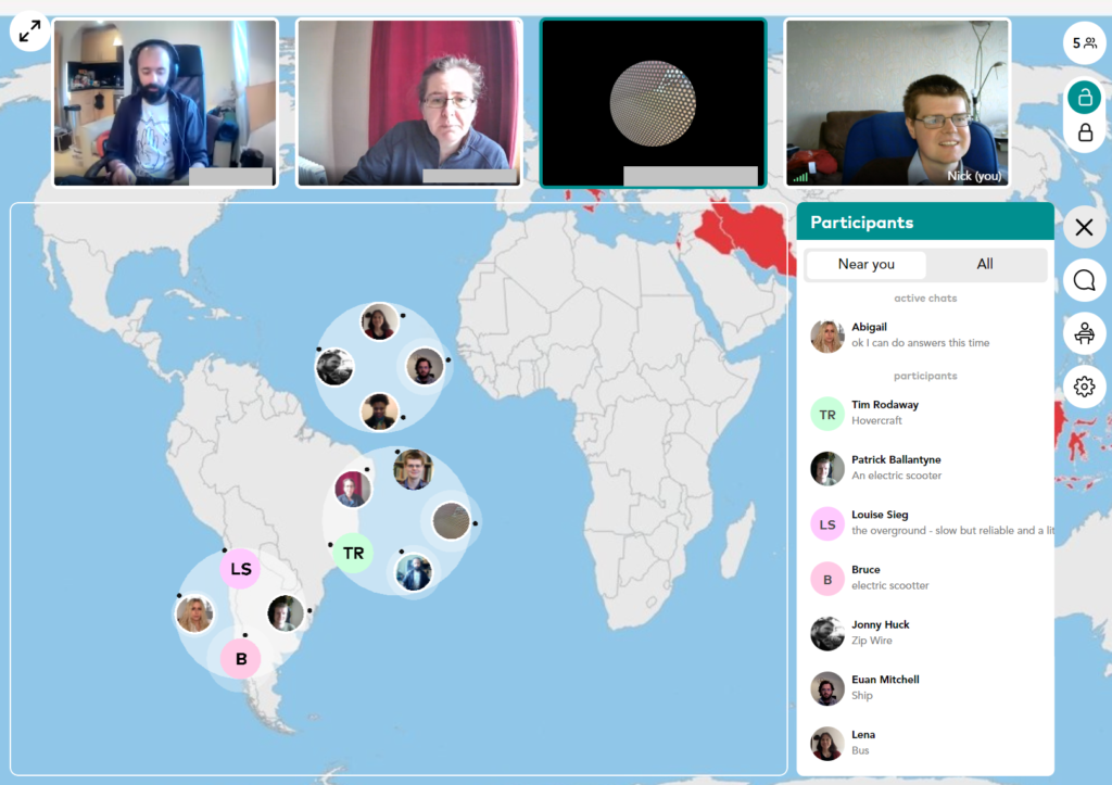
I coordinated the Early Career Workshop sessions before the main conference, and while I am biased, I think they went really well, and the ECRs who attended said they were really useful sessions. The main sessions were on Zoom, and we also experimented a bit with the Wonder.me platform for a quiz and networking, which worked really well.
Quiz and Social on Wonder.me
As ever with GISRUK we had an incredibly wide range of topic presented, from new spatial methods to big data, spatial inequalities and participatory GIS. Uber’s H3 hexagonal grid appeared several times, being a really useful new geography for many types of analysis. One of the big positives is the fact that indexing is a lot easier when working with this geography. It was also great to see presentations from the commercial sector, including Tomas Holderness from AddressCloud, presenting on their work with serverless infrastructure.
GISRUK awards prizes, and this year I managed to actually see most of the winners – parallel sessions makes this a challenge, and there have been years I haven’t seen any of the winners! This years winners were.
Best Long Paper: 23 Naturally Urban? Tackling Inequalities in Urban Greenspace and Wellbeing, by Victoria Houlden
Best Short Paper: 53 Georeferencing historical telephone directories to understand innovation diffusion and social change, by Nikki Tanu, Maurizio Gibin and Paul Longley
Best ECR Paper: 65 Do we need legends? An eye tracking study, by Jess Hepburn, David Fairbairn, Philip James and Alistair Ford
Best ECR Paper: 48 Geo-information tools for stakeholder engagement in environmental decision-making: “best practice” recommendations from a UK case study, by Caitlin Hafferty, Robert Berry and Scott Orford
CASA Prize: in the memory of Sinesio Alves Junior Prize, 38 Profiling the Dynamic Pattern of Bike-sharing Stations: a case study of Citi Bike in New York City, by Yunzhe Liu, Meixu Chen, Daniel Arribas-Bel and Alex Singleton
The papers from GISRUK are also now available on Zonodo, a long term repository where all GISRUK papers will now be kept. The presentations were also videoed, and the recordings are now available. Next year University of Liverpool are hosting GISRUK, and hopefully we will be back to an in person conference then! Looking forward to seeing you there!
Online conferences are everywhere now – and everything now has online as a prefix. The GISRUK 2020 conference was no exception, and originally scheduled for 21th – 24th April, it was postponed and moved online, to 21st to 23rd July. GISRUK is the largest annual GIS research conference, bringing together academics, researchers and students, as well as those from government, commercial and other sectors interested in GIS and its applications.
We had a excellent selection of keynotes, including Tao Cheng, Mark Birkin, Bruno Sánchez-Andrade Nuño and Krzysztof Janowicz. One theme that cropped up several times was that of networks and graphs as a new spatial data format, that one day might sit alongside vector and raster data sets – I will need to update my Intro to GIS slides! Tao talked about how we can think about networks underpinning urban areas, that we can turn any spatial data structure into a network, and that often the network links are much more important that the nodes themselves. Also, graphs and networks lend themselves to temporal data, with network links changing over time, which traditional GIS data structures have struggled to capture. Krzysztof Janowicz extended this to talk about knowledge graphs, linked data and the semantic web, and how graphs as a data structure underpin this. This allowed him and his team to develop knowledge based geo-enrichment, allowing us to ask questions of data that required both geo and non-geo inputs. He also included a great quote:
No conference is complete without the social element, and I have yet to attend a conference that truly cracks this problem. No amount of video conferencing software can replicate waiting in line for lunch and having a chat with whoever happens to be there! GISRUK has a social roulette space where people could go and chat, but it didn’t get a lot of use, potentially because of timing and a 10:00 – 17:00 programme being quite full on. Two elements that worked really well and created a good range of social interaction was the social quiz and tea time conversation with Sarah Wise. James Haworth confirmed the British tradition of being great at creating quizzes by putting together a four round quiz for us; identifying universities based on their logos, identifying cities that GISRUK had been to before based on interesting facts (e.g where was Marks and Spencer founded?), some great GCSE Geography questions(!) and identifying cities based on aerial photos.
Social wise, this was continued the following evening by an absolutely amazing panel discussion hosted by Sarah Wise. The panel, Denise McKenzie (Benchmark Initiative, Geovation, UK), Licia Capra (Professor of Pervasive Computing, Department of Computer Science, University College London) & Monica Stephens (Ph.D., University of Arizona, 2012), fielded Sarah’s questions with ease and provided amazing insight into their current work, challenges facing the GIS community. She also included some fun questions, including your favourite game (I’m glad to see Settlers of Catan was mentioned several times!), and what tattoo would you get to represent your work, in a reflective, pessimistic Pacific Rim style (I can’t remember the exact phrasing – please do comment if you remember!). Monica advised everyone to start blogging and putting your thoughts out there – something I can heartily recommend. Denise also gave some great careers advice for the ECRs (and all of us) listening – be open to what opportunities come your way, and that no-one would have been able to describe her current role to her when she was 21! This particularly resonates with me; my career plan was to do the traditional academic path and become a lecturer, professor etc. and I have taken a wildly different route, but suffice to say that I am happy with what I am doing, and happier that I think I would be if I was a lecturer (although that is another blog post!).
One massive plus of the online model is that it increases accessibility, and we had a great many more people register for GISRUK online than in person (~600 registrations, compared with 200 in person). We had people from all across the world, which is a great change to our usual UK and northern Europe focus.
As usual, GISRUK gives prizes to the Best Paper and Best Short Paper, voted on by the attendees. I would like to offer my congratulations to the prize winners this year:
Every year the local organising committee do a fantastic job pulling the conference together, and Andrea Ballatore (Brikbeck) and James Haworth (UCL) did a great job this year:
— Andrea Ballatore 🗺️🇺🇦 (@a_ballatore) July 22, 2020
Finally, I look forward to seeing you at the next GISRUK, which will be hosted by Cardiff University. Details to follow, please join the mailing list to find out more.
GISRUK is the annual GIS Research
conference in the UK which showcases the latest in GIS (Geographical
Information Science) and Geomatics Research from the UK and across Europe. I
attended the 4-day conference at Newcastle University and it
was amazing to see the latest developments from across the geospatial
community.
One of the key themes for me that emerged from the conference
was the debate between whether spatial data is ‘special’ or is it data just
another data type, one among many? For many years when GIS was a niche area
requiring specialist skills to use, there was a clear argument that spatial was
special. Now the bar of entry to using spatial data is much lower, through the
use of tools such as Google Earth, Tableau and even ArcGIS Pro, which means
many more people can get the benefit of using spatial data and analysis.
Spatial data is another tool in the toolbox of analysts, which allow us to be
solution architects (solving problems) rather than geo-engineers (tinkering
with projections and file formats). I don’t think we are yet at the point where
using spatial data is as easy as using an Excel table, but we are so much
closer than we were even just 5 or 10 years ago. The traditional desktop GIS
package (ArcGIS / QGIS) is no longer the only way of working with spatial data:
advanced users have more data science orientated solutions such as Python or R,
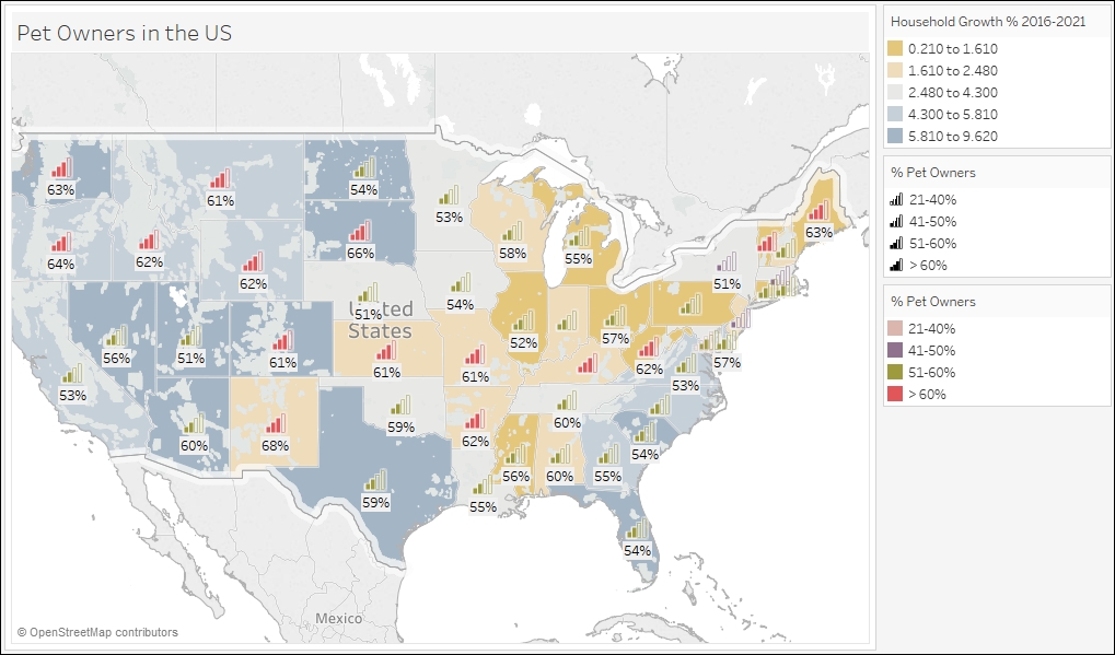
and non-technical users can get great maps from Tableau. In fact James
Bowles found many organisations in the third sector (charities and
NGOs) use Tableau to do data analysis (including spatial analysis) rather than
using tools like ArcGIS.
Spatial data is becoming more widely accessible, with many
users in the third sector choosing Tableau for their spatial analysis, over
traditional desktop GIS such as ArcGIS or QGIS.
One of the regular features of the GISRUK Conference Series
is a key focus on Early Career Researchers, those students who are currently
studying MScs or PhDs. About 60% of them will go straight to work in industry
after their studies, so this is a great opportunity for them to find out more
about working in industry. Both junior staff and senior consultants came in from
ARUP to
explain what ARUP do and why the students’ skills are vital in industry. One of
the big areas of growth is the combination of remote sensing and machine
learning; these skills are very sort after by industry and there are some very
exciting developments in the earth observation field. Machine learning and AI (artificial
intelligence) are gaining a lot of coverage, both in terms of how and where we
use them, but also from the point of view of ‘how do we use AI ethically?’, and
‘what new questions do we have to think about when we are using AI & ML?’.
One of the keynote speakers, Prof. Renee Sieber
talked about the importance of public participation in what she termed ‘GeoAI’
(AI applied in a geospatial setting) and the fact that the fact that AI is not
unbiased at all; it reflects our societal biases and we need to be careful when
using it.
The use of spatial data is fundamental to all of the work
presented at GISRUK, and availability of data is often not as clear cut as it
really should be. In the panel discussion on ‘How will
the opening up of geospatial data help the GIS community?‘ one of
the key elements that was discussed was data infrastructure. The provision of
metadata is often quite important in terms of being able to select suitable
data for specific projects, and if we are to further develop automated data
process (including data selection) then comprehensive metadata is key to much
of this, and currently fairly lacking. Dr Gobe Hobona,
from the Open Geospatial Consortium, demonstrated how the OGC have been
instrumental in developing a range of standards that are key to the interchange
of spatial data between different software and organisations, including the
provision of metadata. Gobe also mentioned the developments of UAVs, both as
tools for spatial data collection but also as transformative decides in
geospatial interoperability, allowing access to more and more varied data
sources. They are also very cool, such as the spectacular swarms of UAVs we saw
at the recent Beijing
Olympics!
UAVs were mentioned across many different themes in the
conference, including for data capture, combination with AI (to identify cracks
in road surfaces) to impact on birdlife in wildlife reserves. They are clearly now
entering a phase where they are part of a wider toolbox, rather than a novelty
in themselves, and so are maturing into a new data source and product. There
was also a very interesting presentation by Kevin Minors on
crowd management, including techniques for modelling the crowd as a whole from
a series of static data points, which has a wide application in highly variable
crowds, such as railway stations.
Overall this was a great conference with a fascinating insight into the cutting edge of research in spatial data and GIS. Next year GISRUK is at UCL and Birkbeck, University of London, April 21st to 24th – see you there!
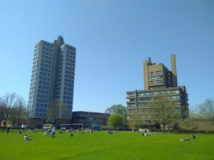
Last week I attended an amazingly sunny GISRUK (Geographic Information Science Research UK) conference in Leicester. I have fond memories of Leicester, as I completed my BSc Geography (2003-2006) and MSc GIS (2007 – 2008) there. Much of the university and city has changed, but an amazing amount is still the same – both in the Bennett building lecture theatres and certain well frequented take-aways!
University of Leicester – Attenborough Tower (L) and Charles Wilson Building (R)
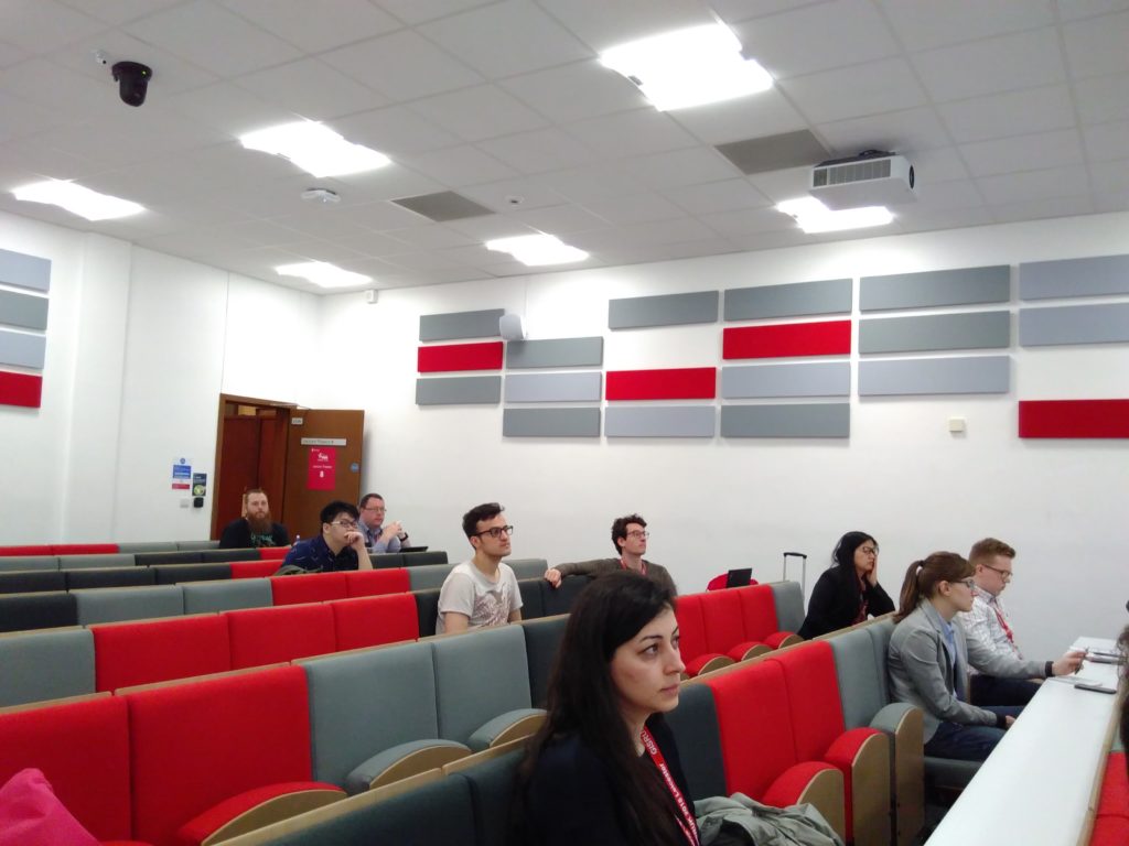
I coordinated the Early Career workshops, where those early in their GIS careers (including, but not limited to, PhD and MSc students) came together for two half-day sessions to find out more about GIS as a career in academia and industry, to learn more and compare notes about their respective PhD/MSc experiences, and most importantly, to get to know each other before the main conference! We had a great variety of input from James Norris (Ordnance Survey / Group on Earth Observations / AGI), James Kendall (RGS), Dave Unwin (ex University of Leicester & Birkbeck), May Yuan (Editor-in-Cheif IJGIS, University of Texas at Dallas), Addy Popy (ESRI UK) and Katie Hall (ESRI UK).
Early Careers session in full flow
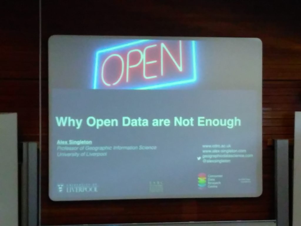
The main conference had a great selection of talks and presentations covering every application of GIS from archaeology, to crime, health, transport, and urban studies! It is always a challenge to work out which of the three parallel sessions to attend, and I can’t attend everything. Particularly of note for me was Alex Singleton’s keynote on ‘Why Open Data are Not Enough’, discussing some of the issues with open spatial data, particularly in terms of data longevity which very much reminds me of this XKCD comic, and still really hasn’t been solved for spatial data. This was rather well illustrated by the CDRC Data Store that has been developed through the Consumer Data Research Centre; there is no mechanism for ensuring this continues after the CDRC funding finishes, and this is the norm with many academic projects.
Alex Singleton: Why Open data are Not Enough
There was also a great presentation by Sam Cockings looking at how we can better model day time populations, from a variety of data sources. Integrating many real time data sources is going to be a key aspect of spatial data management in the future and I can see many projects using the skills and technologies Sam described.
Next year GISRUK 2019 will be in Newcastle University, and I look forward to seeing you there!
If you would like a chat about GIS Research, or GIS Training for small groups, please do email nick@geospatialtrainingsolutions.co.uk or give me a call on 01209 808910.